The Drop
DRIVEN BY CHALLENGE. DEFINED BY RESULTS.™
Category: Landscape
-
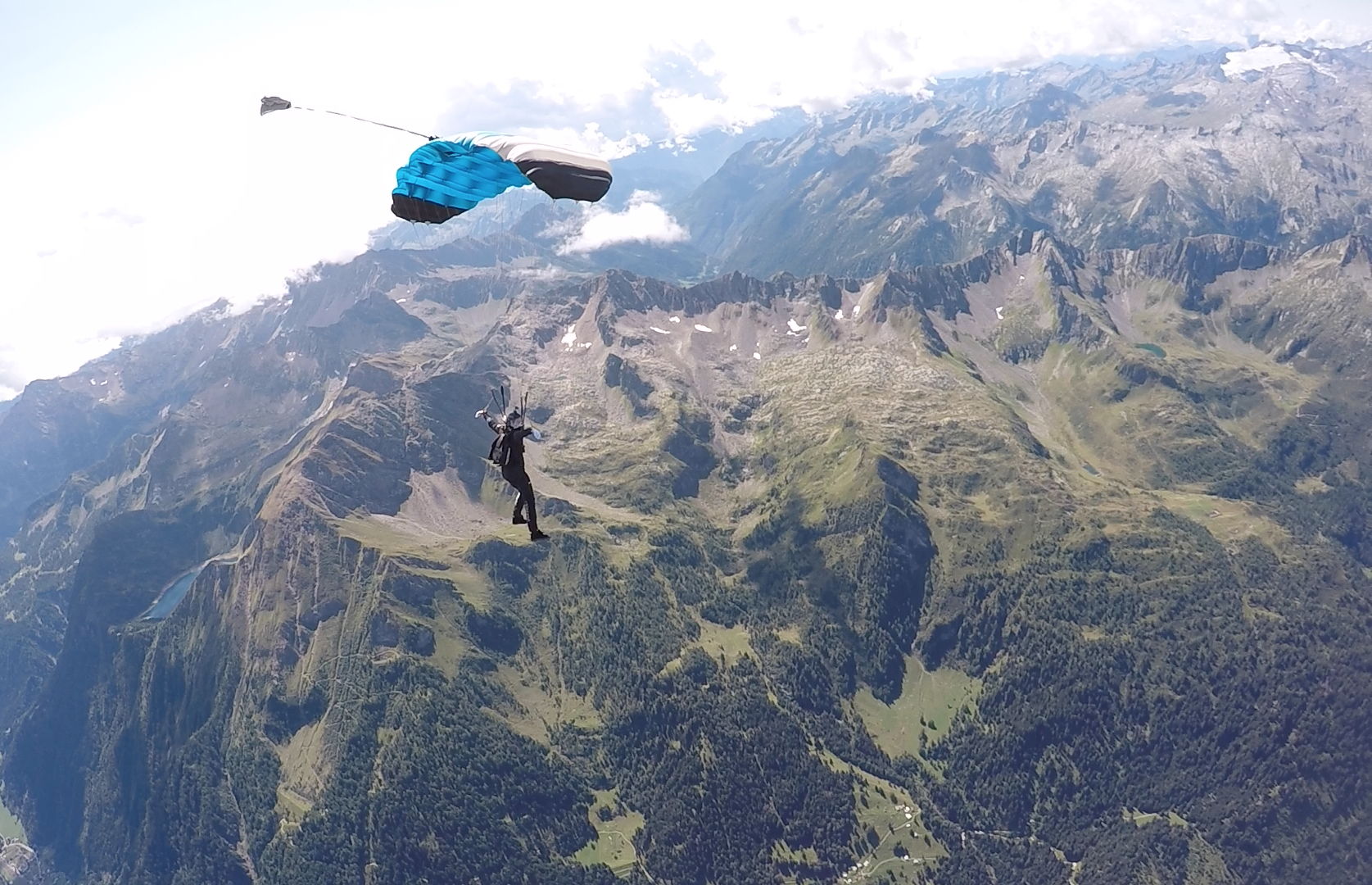
After competing at the 2017 World Cup in Germany, Brianne Thompson and Niklas Daniel of AXIS Flight School attended the Mountain Gravity event to fly their parachutes in the Swiss Alps. Jumping out of the legendary Pink Skyvan, participants came from all over the world to take in the fantastic scenery at the Ambri Airport,…
-
Mike Hall jumps with the American flag while the sun begins to set at Skydive Arizona in Eloy.
-
I would like to thank Dave at Skydive Radio for making my image below their pic of the week! Skydive Radio is the world’s leading internet radio show dedicated to the sport of skydiving. Weekly episodes include commentary, feature interviews with industry insiders, listener-contributed photos, and e-mails from an audience that spans the globe.
-
“Antelope Canyon is the most-visited and most-photographed slot canyon in the American Southwest. It is located on Navajo land near Page, Arizona. Antelope Canyon includes two separate, photogenic slot canyon sections, referred to individually as Upper Antelope Canyon or The Crack; and Lower Antelope Canyon or The Corkscrew. Entry to Antelope Canyon is restricted to guided tours led by authorized guides. The Navajo name for Upper Antelope Canyon is Tsé bighánílíní, which means “the place…
-
It just so happens that Utah’s Arches National Park is only a 15 minute drive from Skydive Moab. So after the MOAB Boogie I spent a few hours hiking through the park while the sun was setting. Here are a few of my selects:
-
Most of the time I am not lucky enough to have a camera on hand when rainbows appear. To the left you will find a picture I took of the Skyventure Arizona tunnel yesterday afternoon, after a rainstrom passed thorough the area. In order to track my progress in shooting this phenomena, I have added another image to…
-
Here are a couple of more time lapse tests from around the Skydive Arizona Drop Zone.